Plan to control Glidden land use
January 18, 1990
The South Annie Glidden Road Corridor Plan will control uses, access points, aesthetics and the development of land on the 100-year floodplain, according to the DeKalb Planning Commission.
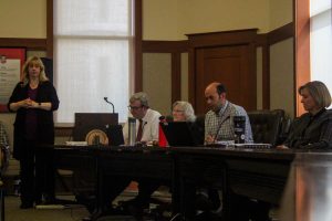
The commission presented a preliminary draft of the plan to the DeKalb City Council and the public Monday night.
Forty percent of the 1,150 acres along the corridor will be used for single-family housing, said Planning Commission Director Mark Biernacki.
Apartment complexes will be limited to 16 units per acre, Biernacki said. Sixty percent of the land will be used for non-residential purposes such as offices, parks or a golf course, he said.
The city also plans to limit to 10 the number of access points to South Annie Glidden Road, Biernacki said. A similar, randomly selected stretch of Sycamore Road has 80 access points, he said.
The commission envisions the Annie Glidden Road of the future as a tree-lined boulevard with a landscaped median strip. The commission recommended strict regulations for signs, landscaping and building size along the boulevard.
Evergreen hedges or decorative walls were proposed as part of the plan to hide commercial and residential development from motorists’ view.
The Planning Commission has “whittled away” the potential for commercial or residential development on the portion of South Annie Glidden Road that lies on the 100-year floodplain, Biernacki said.
Seventy-one percent of the floodplain acres would be developed for recreational uses, such as parks or golf courses, he said. Forty-five acres of floodplain land could be developed for non-recreational uses, though the city of DeKalb may acquire that land for recreational use as well, Biernacki said.
Council members will vote on the proposal Monday, said Jerry Sagona, administrative intern for the city manager’s office.


